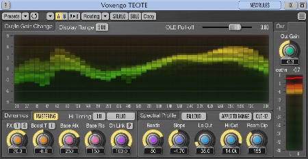
TeamCubeadooby | x64: VST3, VST2, AAX | x86: VST3, VST2 | 14.8 MB
Mastering Balancer Plugin
Полная новость
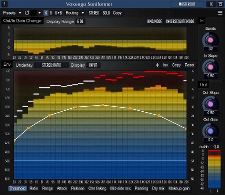
TeamCubeadooby | x64: VST3, VST2, AAX | x86: VST2 (VST3 no exist) | 14.5 MB
Spectral Dynamics Processor
Полная новость
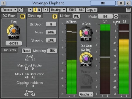
TeamCubeadooby | x64: VST3, VST2, AAX | x86: VST3, VST2 | 14.7 MB
Voxengo Elephant is a mastering limiter AAX, AudioUnit, and VST plugin for professional sound and music production applications. The most remarkable feature of this signal limiter is its sonic transparency. Elephant brings sound limiting and loudness maximization without audible "fuzz" and "pumping" sonic artifacts.
Полная новость
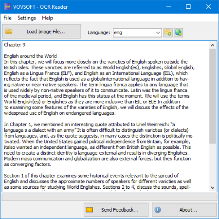
File size: 20 MB
Optical Character Recognition (OCR) is the electronic or mechanical conversion of images of typed, handwritten or printed text into machine-encoded text, whether from a scanned document, a photo of a document.
Полная новость
File size: 152 MB
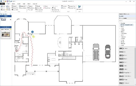
ScenePD - Comprehensive Crime Scene and Crash Diagramming Software.
Полная новость

File size: 153 MB
GIS INTEGRATION
Полная новость

Журнал по квилтингу и пэчворку. На его страницах собрано множество великолепных, интересных проектов, созданных в технике лоскутного шитья. В каждом выпуске авторы журнала предлагают рукодельницам новые, современные проекты для изготовления одеял, подушек и разных вещей для создания комфорта и уюта в доме.
Полная новость
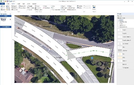
File size: 152 MB
Gis integration. Incorporate customers' existing GIS services
Полная новость
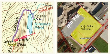
File size: 23 MB
ExpertGPS is the ultimate GPS map software for planning outdoor adventures. View GPS waypoints and tracklogs from any handheld GPS receiver over aerial photos and US topographic maps. Plan your next outdoor adventure over scanned USGS topo maps and send a route directly to your GPS receiver to guide you in the field. View your GPS tracklog over an aerial photo to see exactly where you went.
Полная новость
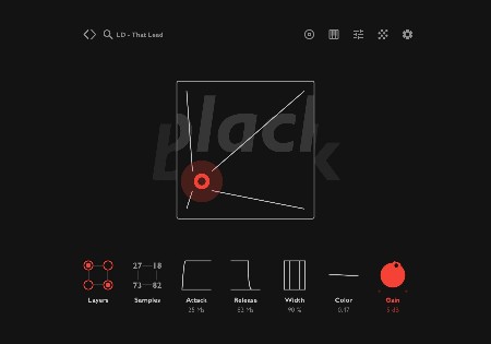
MOCHA | 9 December 2022 | AU VST VST3 | 114 MB
Trap? Lo-fi? Hip-Hop? Drill?
Полная новость